Round the world
-
After creating a basic map for our round-the-world itinerary and then adding photos when placemarkers are clicked, today we're going to add some handy labels to the map to show rough dates for when we'll be arriving in a particular location. This actually proved trickier than expected: there's an old library called MapLabel that works well with the Google Maps API, but it doesn't load asynchronously in a straightforward way. So I had to jump through some hoops to load it only when the main Google Maps API is available, avoiding some irritating load errors. I used some code from…
-
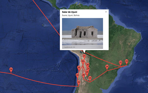
In the last post we looked at a basic implementation of a round-the-world itinerary in Google Maps. In today's post we're going to add the ability to see the first photo associated with a location when you click on it. The Google Maps API makes it fairly easy to get the photos associated with a particular place, but it helps to identify that place uniquely: while you can search for a place based on its name, it's more efficient and reliable to get its unique "place ID" and use that instead. I used this handy PlaceD Finder tool to get…
-
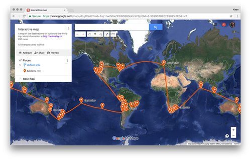
Over the next few posts I'm going to talk about the process I went through to integrate the itinerary for our imminent round-the-world trip into the awesome web-site my wife has set up. The initial approach I took was to use Google My Maps: this is a really cool tool for creating a custom map without any coding needed (yes, I know – that doesn't sound like much fun :-). For instance, you can set up your placemarks and link them with a route, and when individual places are clicked it shows a nice sliding info panel. I started out…
-
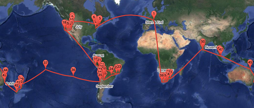
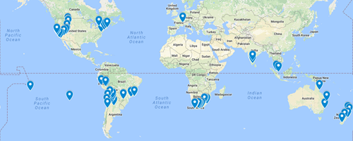
It's now less than a week before my family and I get on a plane and start our big trip: visiting 13 countries on 5 continents (not including the one we're starting from) over the course of 6 months. We leave on July 2nd, 2017, and – if our plans don't change – will return home on January 5th, 2018. Here's a map of where we're going… be sure to zoom into different locations and click on the place-markers to bring up additional information. It's been a deliberate choice, over the years, not to talk much about my family on…
-
Most of my team has been 100% focused on an event taking place in Toronto, this week, the Symposium on Simulation for Architecture and Urban Design (or SimAUD). This is a really interesting conference for people working in our space: I'm looking forward to attending myself, at some point. As the only non-Toronto based member of the team, it made sense for me to skip it (and given the fact I'm about to embark on a 6-month trip – including some time in Toronto – I didn't even suggest that I attend). This meant that I ended up spending the…
-
We've crossed a pretty big milestone in the plans for my family's round the world trip for the latter half of 2017: we've actually booked flights. Here's how the latest location tracker looks: You can compare this with the more speculative plan from last time – which still holds good for most areas – to get a sense for the timing and flow. The first image includes prospective destinations reached overland – we'll be renting cars/RVs/motor-homes in various locations, as well as taking a fair amount of public ground transportation. We're crossing our fingers that the bus from Salta, Argentina…